


GLIERES / BORNES: LE CHESNET - SUR COU - COL DU FREU

djeepee74
User
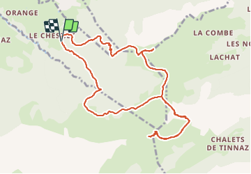

Length
11.9 km

Max alt
1797 m

Uphill gradient
810 m
Km-Effort
23 km

Min alt
1175 m

Downhill gradient
813 m
Boucle
Yes
Creation date :
2020-08-15 06:46:46.693
Updated on :
2021-09-22 14:04:36.641
4h30
Difficulty : Medium

FREE GPS app for hiking
 SityTrail
IGN / Geographical institutes
SityTrail Plus
The world is yours!
About
Trail Walking of 11.9 km to be discovered at Auvergne-Rhône-Alpes, Upper Savoy, La Roche-sur-Foron. This trail is proposed by djeepee74.
Description
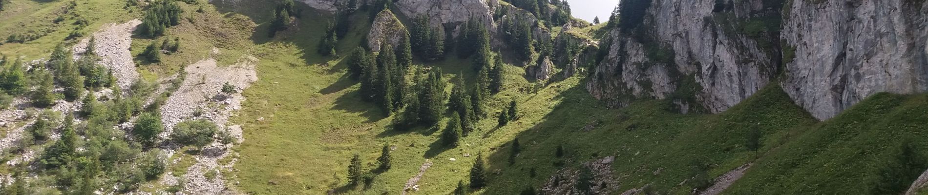
BOUCLE... live le 20200815
Repérage col du câble & pas de la truie... humides à la descente !
Photos


Positioning
Country:
France
Region :
Auvergne-Rhône-Alpes
Department/Province :
Upper Savoy
Municipality :
La Roche-sur-Foron
Location:
Unknown
Start:(Dec)
Start:(UTM)
292845 ; 5099906 (32T) N.
Comments